
TL;DR

Prime made for students and young adults
- Fast, free delivery for dorm and study essentials
- Prime Video and Amazon Music included
- Member-only deals
Submarines rely on a combination of sonar, inertial navigation, and satellite signals to determine their position underwater. While these methods are effective, some uncertainties remain about their precision in deep or GPS-denied environments.
Submarines determine their position underwater primarily through a combination of sonar, inertial navigation systems, and satellite signals when near the surface. These methods are crucial for navigation, especially in GPS-denied environments, and are continuously evolving with new technological advancements, according to defense and maritime experts.
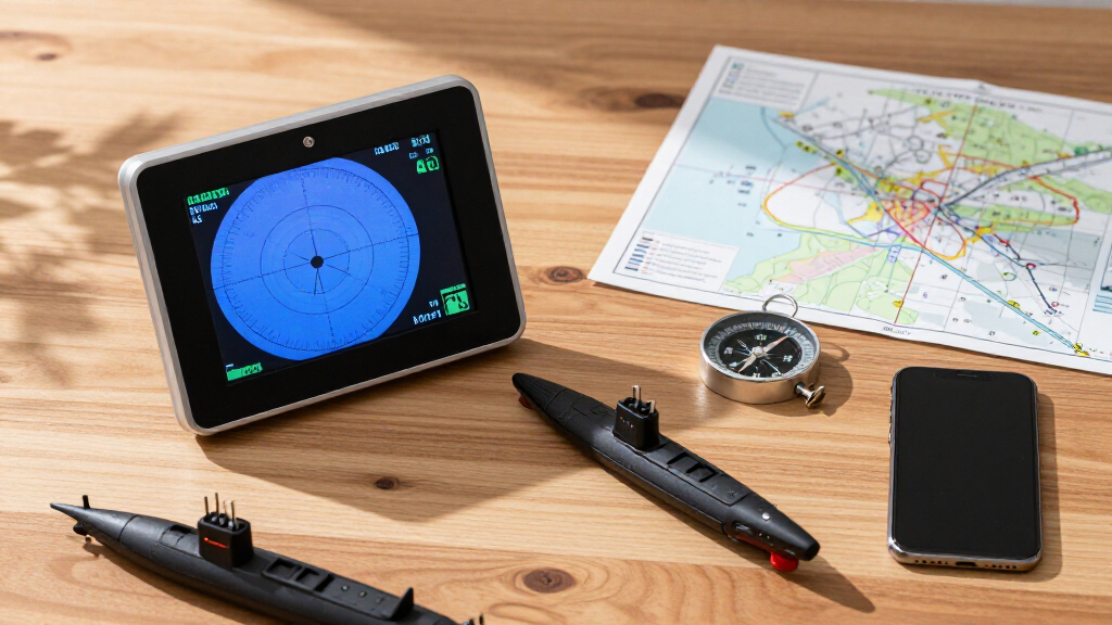
Currently, submarines use sonar systems to detect their surroundings and estimate their position relative to known underwater features or previously mapped areas. Learn more about underwater detection technologies. Inertial navigation systems (INS) track movement based on accelerometers and gyroscopes, providing continuous position estimates without external signals. When near the surface, submarines can also use satellite signals like GPS to update their location, but GPS signals do not penetrate deep underwater.
To bridge the gaps when GPS is unavailable, submarines employ underwater acoustic positioning systems and dead reckoning techniques, which combine data from multiple sensors. Researchers are exploring new sensor fusion methods and machine learning algorithms to improve accuracy and reliability in challenging environments. For related insights, see summer solstice and environmental data.
Why Accurate Positioning Is Critical for Submarines
Precise underwater navigation is vital for submarine safety, stealth, and operational effectiveness. Errors in positioning can lead to collisions, mission failures, or detection by adversaries. As submarines become more advanced, improving their navigation capabilities directly impacts national security and maritime sovereignty.
As an affiliate, we earn on qualifying purchases.
Historically, submarines relied heavily on inertial navigation, which accumulates errors over time. The advent of satellite navigation like GPS revolutionized surface navigation but is limited underwater. To counter this, navies have developed acoustic positioning systems, such as Long Baseline (LBL) and Ultra-Short Baseline (USBL) systems, for more accurate underwater localization. Recent research focuses on integrating these methods with artificial intelligence to enhance real-time positioning accuracy, especially in deep or complex underwater terrains.
inertial navigation system for boats
As an affiliate, we earn on qualifying purchases.
As an affiliate, we earn on qualifying purchases.
Unresolved Challenges in Deep-Water Positioning Accuracy
Despite technological progress, challenges remain in achieving pinpoint accuracy in deep-sea environments, especially over long durations without external updates. The limits of acoustic systems and sensor drift in inertial navigation still pose risks, and it is unclear how soon new innovations will fully address these issues.
satellite GPS receiver for marine use
As an affiliate, we earn on qualifying purchases.
As an affiliate, we earn on qualifying purchases.
Researchers are focusing on integrating machine learning with sensor data to enhance real-time accuracy. Naval agencies are testing new hybrid systems combining acoustic, inertial, and satellite data, with expected deployment in upcoming submarine classes within the next few years. Continued advancements aim to close existing gaps in deep-sea navigation precision.
underwater acoustic positioning system
As an affiliate, we earn on qualifying purchases.
As an affiliate, we earn on qualifying purchases.
Key Questions
How do submarines use sonar to find their location?
Submarines use sonar to detect underwater features and other vessels, comparing these signals to known maps or previous data to estimate their position relative to fixed points.
Can submarines rely solely on inertial navigation?
Inertial navigation provides continuous position data but accumulates errors over time, so submarines combine it with other systems like sonar and satellite signals for better accuracy.
Why can’t submarines use GPS underwater?
GPS signals cannot penetrate deep water, so submarines must use alternative methods when submerged, such as acoustic positioning and inertial sensors.
What are the main limitations of current underwater positioning systems?
The main limitations include error accumulation in inertial navigation, signal degradation in complex underwater terrains, and the inability of GPS to work at depth.
Are new technologies improving submarine navigation?
Yes, ongoing research into sensor fusion, machine learning, and advanced acoustic systems aims to improve accuracy and reliability in challenging environments.
Source: rss
Fall Picks
fall essentials
As an affiliate, we earn on qualifying purchases.