
TL;DR

Prime made for students and young adults
- Fast, free delivery for dorm and study essentials
- Prime Video and Amazon Music included
- Member-only deals
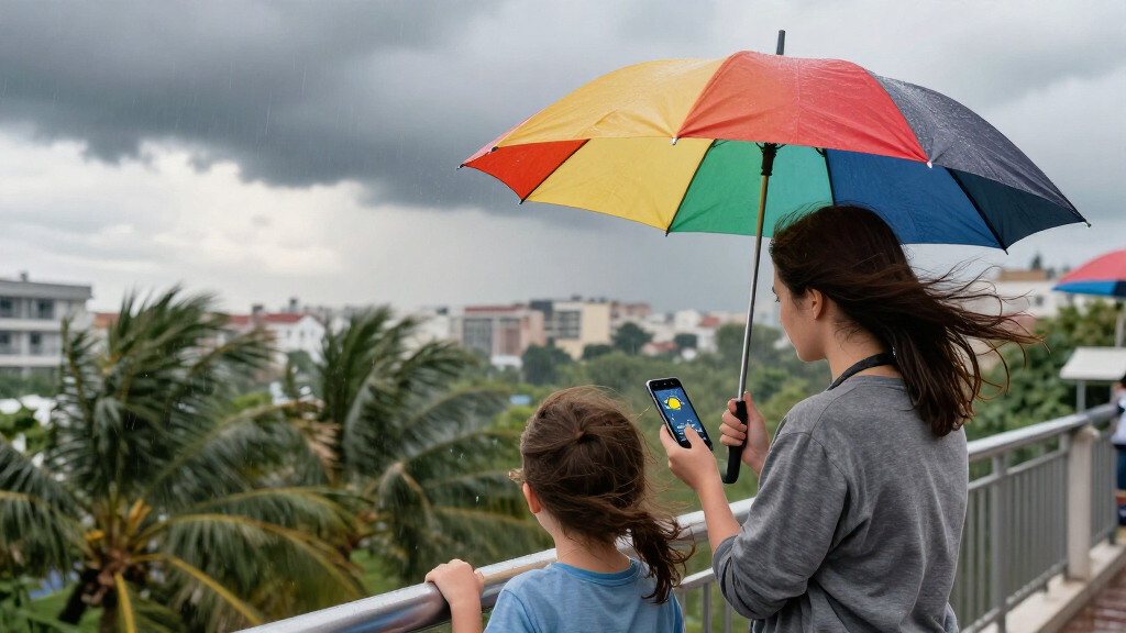
Rio de Janeiro has issued a weather warning for strong winds and heavy rain caused by an approaching cold front. Authorities advise residents to stay alert and take safety precautions as the weather system moves into the region.
Rio de Janeiro has officially issued a warning for strong winds and heavy rain as a cold front moves into the region, prompting authorities to advise residents to exercise caution. The Civil Defense warns of strong winds and heavy rain in Rio. The alert was issued early this morning by the city’s meteorological agency, with forecasts indicating worsening weather conditions over the next 24 hours. This development is significant for residents, commuters, and local authorities preparing for potential disruptions caused by the adverse weather.
The alert from Rio’s meteorological agency confirms that the incoming cold front is expected to bring sustained strong winds, with gusts reaching up to 70 km/h in some areas, and heavy rainfall that could lead to localized flooding. The weather system is currently approaching from the south and is predicted to reach the metropolitan area by late morning, with its effects persisting into the evening.
Authorities have activated emergency response protocols, including the deployment of teams to monitor vulnerable areas prone to flooding and landslides. Public transportation agencies have announced potential delays and cancellations, especially in peripheral neighborhoods and coastal zones where the impact of wind and rain could be more severe. Residents are advised to avoid unnecessary travel, secure outdoor objects, and stay indoors during the storm.
The National Weather Service has issued a state-wide alert, emphasizing the risk of flooding in low-lying areas and the possibility of fallen trees and power outages. Utility companies are on standby to address outages swiftly, and local officials are coordinating with civil defense teams to ensure community safety.
Impacts on Daily Life and Safety Measures
This weather warning is crucial because strong winds and heavy rain can cause significant disruptions, including transportation delays, power outages, and potential safety hazards such as falling trees and flooding. The alert underscores the need for residents to follow safety guidelines and for authorities to be prepared for emergency response. The situation highlights the ongoing vulnerability of urban infrastructure to severe weather events, especially during seasonal transitions.
heavy rain waterproof outdoor umbrella
As an affiliate, we earn on qualifying purchases.
As an affiliate, we earn on qualifying purchases.
Recent Weather Patterns and the Arrival of Cold Fronts
Rio de Janeiro frequently experiences weather fluctuations during the transition between seasons, with cold fronts often bringing sudden drops in temperature and intense rainfall. The current cold front is part of a broader weather pattern affecting southeastern Brazil, where meteorologists have observed increased activity of such systems over the past month. Historically, these fronts can cause localized flooding and wind damage, prompting preemptive warnings from authorities.
While this is a typical seasonal occurrence, the current alert is driven by the forecasted intensity of the winds and rain, which appear to be stronger than average for this time of year. Previous similar events have resulted in road closures, power outages, and minor injuries, emphasizing the importance of preparedness.
The meteorological agency has been monitoring the system since yesterday, and the forecast models indicate that the cold front will continue to influence the weather over the coming days, with possible further alerts if conditions worsen.
stormproof outdoor furniture covers
As an affiliate, we earn on qualifying purchases.
As an affiliate, we earn on qualifying purchases.
Unconfirmed Aspects of the Weather System
While forecasts predict significant impacts from the cold front, the exact timing and intensity of the strongest winds and rainfall are still being refined. There remains some uncertainty about the extent of flooding in specific neighborhoods and the duration of adverse conditions, as weather models continue to be updated.
Additionally, the potential for secondary effects like landslides or widespread power outages depends on how the weather unfolds in the next several hours, which remains uncertain at this stage.
portable emergency power generator
As an affiliate, we earn on qualifying purchases.
As an affiliate, we earn on qualifying purchases.
Monitoring and Preparedness for Ongoing Weather Impact
Authorities will continue to monitor the cold front’s progress and provide updated alerts as necessary. Emergency services are on high alert to respond to incidents, and residents are advised to stay informed through official channels. The weather system is expected to persist into tomorrow, with possible additional warnings if conditions deteriorate further.
Preparations include clearing drainage systems, reinforcing vulnerable structures, and coordinating with utility providers to restore power quickly if outages occur. The public should remain vigilant and follow safety instructions issued by local authorities.
As an affiliate, we earn on qualifying purchases.
Key Questions
How strong are the expected winds?
Gusts are forecasted to reach up to 70 km/h in some areas, which can cause damage to outdoor objects and trees.
Will there be flooding?
Localized flooding is expected in low-lying areas, especially near rivers and coastlines, due to heavy rainfall.
Should I cancel outdoor plans?
Yes, residents are advised to avoid outdoor activities during the storm to prevent accidents and injuries.
How long will the storm last?
The adverse weather is expected to persist into the evening, with conditions gradually improving overnight.
What should I do if I experience a power outage?
Report outages to utility companies and avoid attempting to restore power yourself. Follow safety instructions from local authorities.
Source: local
Halloween Picks
halloween
As an affiliate, we earn on qualifying purchases.